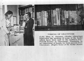
Tokens of Gratitude. (Left) Miss N Sweeney (Works Librarian) supervises the packing of some of the books which have been sent to the Cadbury Fry Pascall factory at Claremont, Tasmania, as an expression of thanks for food parcels from Claremont. (Right) Some of the books chosen.
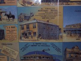
One tourist map of Tasmania dated 1934. Inset map of Hobart. Produced by the Government Printer Tasmania. Scale 1 in: 10 mls , - Linen backed map, folded
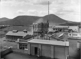
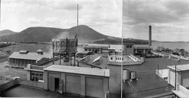
Panorama showing cement tower and chimney stack on top of building forming part of Cadbury site, with view of Derwent River and Mount Direction in distance.
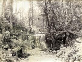
Black-and-white photograph shows path to near base of waterfall in foothills of Mount Wellington, two men standing near a barrel beside a metal mesh and barbed wire fence and a padlocked gate barring access to the stream
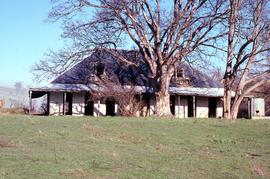
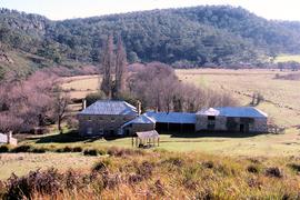
Colour photograph of substantial shingle-roofed dwelling with dormer windows and wrap-around veranda on the property at Montacute, Hollow Tree, overshadowed by mature deciduous trees, photograph taken July 1981
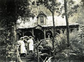
Photograph taken by George Musgrave Parker of the Triabunna Boarding House which was built in the early 1800 by Thomas Martin to provide accommodation for the military from Maria Island
Letter from T.W. Rowlands to Joseph Archer & George Meredith dated 13 January 1836. Judgement against them at suit of Nathaniel Thornton, payment £564 . 17. 4. debt due to Mrs Moore
Collection of unidentified photographs, some of hospitals and staff and some of maritime personnel. Pre- World War One photographs belonging to G.M Parker which were taken in London. These photographs include group portraits of medical staff at St. Bartholomew’s Hospital. While many of the people in these photographs have not been identified, it is likely that Dr Parker features in some of them.
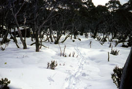
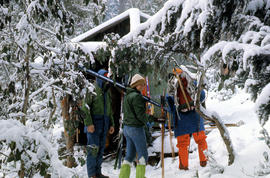
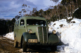
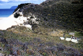
Colour photograph shows two-tone green vehicle with driver's fingers visible on steering wheel, on the unsealed road at National Park, with snow covering the higher ground. Tasmanian number plate reads WLA 189 - 19 TAS 56.
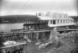
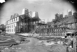
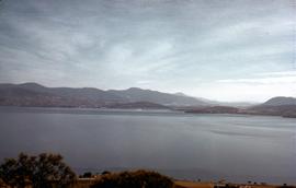
Black-and-white photograph shows view dowhill to River Derwent looking across construction site of E.Z. Co. Zinc Works construction site of 100-Ton Plant
Black-and-white photograph taken from elevated point on Queen’s Domain, looking north up Derwent River towards Cornelian Bay and New Town Bay; Risdon Park Racecourse (1880s-1926) at New Town in foreground, early burial plots in headland of Cornelian Bay Cemetery at right of picture.
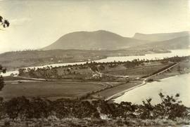
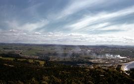
Colour photograph of Burnie hinterland, mouth of Emu River at Emu Bay and smoke billowing from the APPM pulp and paper mill at South Burnie, taken from top of Round Hill. looking west-south-west/
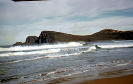
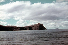
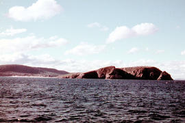
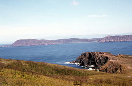
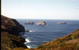
Colour photograph of waves breaking in Lighthouse Bay, with cliffs and headland of Cape Bruny and Bruny Island Lighthouse in background. Discolouration in scanned image from original slide.
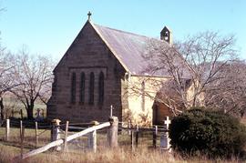
Colour photograph taken in winter, shows burial ground and churchyard surrounding St James Chapel at Montacute, under the care of the Hallett Family, since 1897
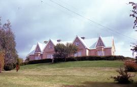
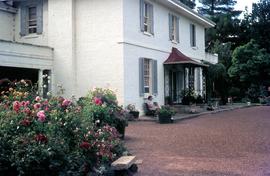
Colour photograph of Clifton Priory, Bothwell, showing powerlines across front lawn below hedge. National heritage register citation is as follows: “Two storey stone Tudor Gothic house built in 1847-8 by Rev. Robert Wilson from public subscription. Wilson caused a scandal when he ran into financial difficulties and sold it owing a considerable sum. The house is magnificently sited on Barrack Hill from where it enjoys fine views of Bothwell, the Clyde River and surrounding countryside.”
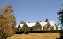
Colour photograph of Clifton Priory, Bothwell, showing gardens, lawn and hedge below front door. National heritage register citation is as follows: “Two storey stone Tudor Gothic house built in 1847-8 by Rev. Robert Wilson from public subscription. Wilson caused a scandal when he ran into financial difficulties and sold it owing a considerable sum. The house is magnificently sited on Barrack Hill from where it enjoys fine views of Bothwell, the Clyde River and surrounding countryside.”
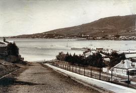
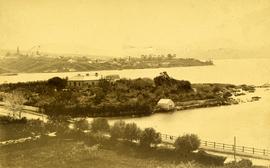
Black-and-white photograph shows Sandy Bay Road in foreground, the grand home St Helena on what is known as Dunkleys Point, and Battery Point on the opposite shore of the bay
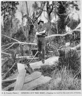
Image likely sourced from a newspaper or publication as it contains printed legend at the bottom: Opening out of the west - clearing the land for the new town of Crotty. Photographer identified. Primitive buildings just visible in the background. It is likely the image is older than 1902.
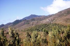
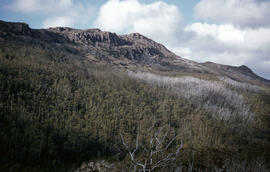
Colour photograph shows three people standing on a former industrial site at Crotty, in front of Mount Jukes, a rocky mountaintop with heavily timbered foothills.
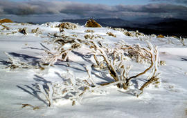
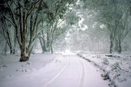
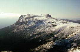
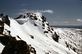
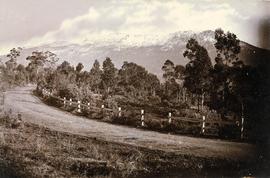
Black-and-white photograph shows snow on Mount Wellington viewed from the verge of the Huon Road, South Hobart, with post-and-rail fence alongside roadway.
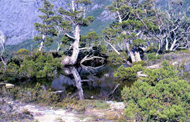
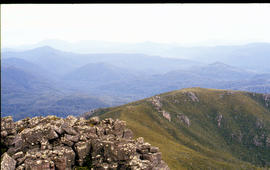
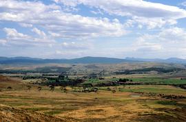
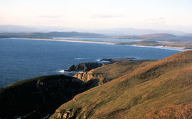
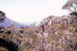
Colour photograph shows man standing on a ridge on Mount Lord, looking across the Lawrence valley, where the Lawrence Rivulet flows. Man is standing amid tall specimens of Pandani, Richea pandanifolia.
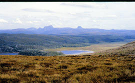
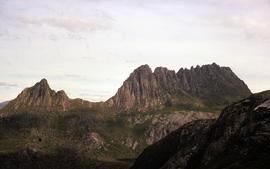
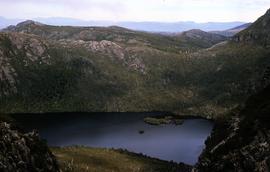
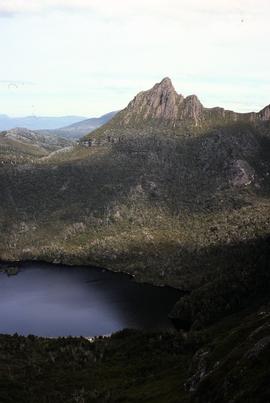
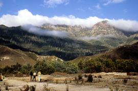
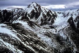
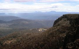
Colour photograph shows view from Devils Gullet Lookout towards Cradle Mountain and Barn Bluff with earthworks surrounding Fisher Power Station on hill in foreground
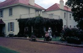
Colour photograph shows a woman seated on park bench outside main house at Brickendon, historic 465ha estate established and farmed by William Archer and descendants since 1824, who invited tourists to their property from the late 20th century.
Colour photograph shows two sightseers, man with camera hanging on strap around his neck and gloved woman carrying handbag, outside main house at Brickendon, historic 465ha estate established and farmed by William Archer and descendants since 1824, who invited tourists to their property from the late 20th century.