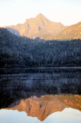
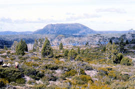
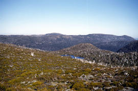
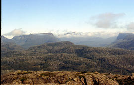
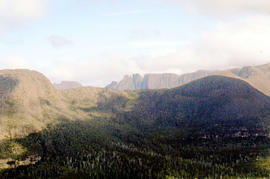
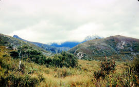
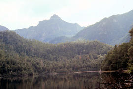
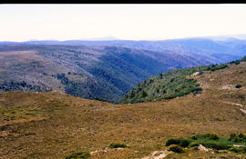
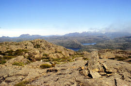
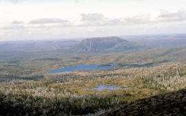
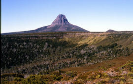
Ragged Jack
Add to clipboard
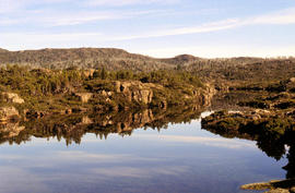
Colour photograph shows view of forest and mountain ranges from Mayday Mountain
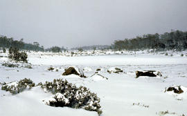
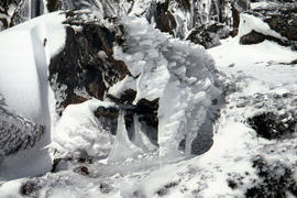
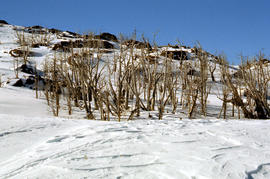
Pool of Bethesda
Add to clipboard
Colour photograph shows snow covering the Pool of Siloam near The Temple below Mount Jerusalem
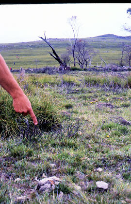
Pointing out a dead bird
Add to clipboard
Colour photograph shows a person pointing at a dead bird on the ground near Bare Mountain, with new undergrowth shooting after a recent bushfire and several bushwalkers visible in the distance
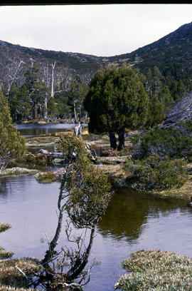
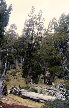
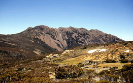
Pencil Pines near Dixons Kingdom
Add to clipboard
Colour photograph shows Piesse Vale at Ben Lomond plateau dusted with snow GIS Latitude -4154 Longitude 14763 Gazetteer Record_ID TAS13722
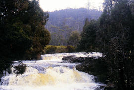
Pencil Pine Creek Falls
Add to clipboard
Colour photograph shows Pencil Pines growing in alpine forest near Dixons Kingdom hut
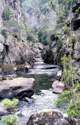
Paddys Lake
Add to clipboard
Colour photograph shows whitewater section of Pencil Pine Creek
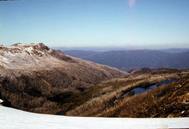
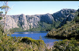
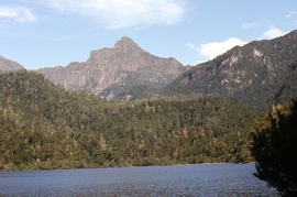
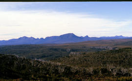
Mt Solitary and Lake Pedder
Add to clipboard
Colour photograph taken from elevated mountain ridge, shows valley floor looking west to Mount Solitary and original shoreline of Lake Pedder
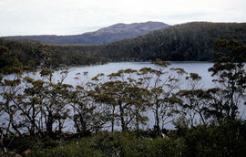
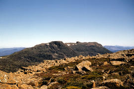
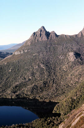
Mount Rogoona
Add to clipboard
Colour photograph shows Mount Rogoona with Lake Myrtle obscured by light alpine forest vegetation on ridge
Mount Eliza covered in low cloud
Add to clipboard
Colour photograph shows lightly timbered heath and woodland and Mount Eliza in the background covered in low cloud
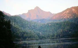
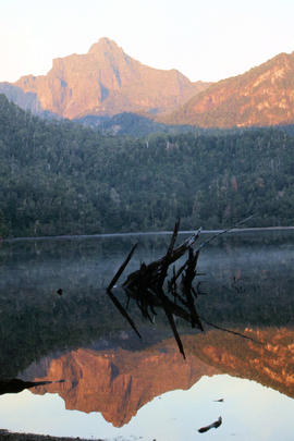
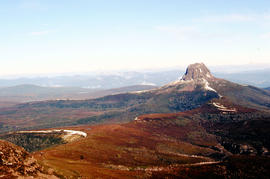
Mount Anne at sunrise
Add to clipboard
Colour photograph shows Mount Anne at sunrise as viewed from across Lake Timk
Mount Anne at sunrise
Add to clipboard
Colour photograph shows silhouette of Mount Anne, viewed at sunset
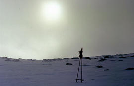
Morning mist on Ben Lomond 1962
Add to clipboard
Colour photograph shows pair of gloves on a set of ski poles pitched into snow atop Ben Lomond, with mist covering the sun
Man with skis on Mount Barrow
Add to clipboard
Colour photograph shows heavy snow cover on Mount Barrow with man carrying skis next to guideposts alongside road
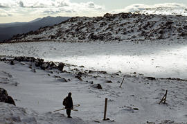
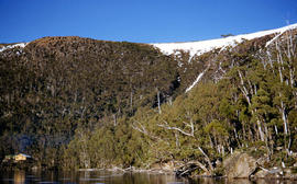
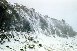
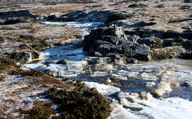
Low cloud over Mount Bridges
Add to clipboard
Colour portrait format photograph shows low cloud over Mount Bridges, with patches of snow on the ground
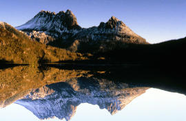
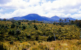
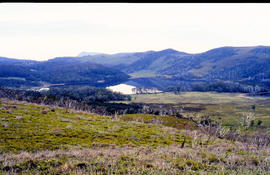
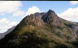
Looking south to Cradle Mountain
Add to clipboard
Colour photograph shows the heathland on the Central Plateau, south of Cradle Mountain, with the mountain peaks visible in the distance
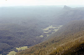
Lees Paddock and Mount Pillinger
Add to clipboard
Colour photograph shows the cleared land of Lees Paddocks in the upper Mersey Valley, surrounded by bush with Mount Pillinger in the background
Lake Timk and Mount Anne
Add to clipboard
Colour photograph shows Lake Timk and Mount Anne in distance GIS: Latitude -4293 Longitude 14646 Gazetteer Australia Record_ID TAS16882
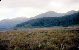
Lake Edgar in the distance
Add to clipboard
Colour photograph shows low cloud obscuring the forest and ridgelines where Lake Edgar is visible in the distance
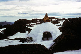
Igloo at Mount Field West
Add to clipboard
Colour photograph shows two bearded men posing on the top or in doorway of an igloo built at Mount Field West, 1975
Ice skating on Lake Dobson
Add to clipboard
Colour photograph shows two people standing upright on the frozen surface of Lake Dobson, 1954
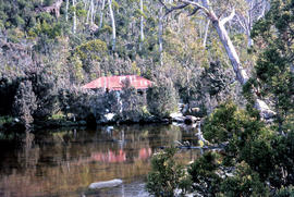
Hut at Twilight Tarn
Add to clipboard
Colour photograph shows the rusting red roofing iron on hut visible above trees on the edge of Twilight Tarn
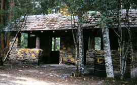
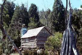
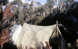
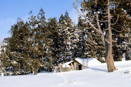
Hut at Lake Meston 1977
Add to clipboard
Colour photograph shows hut at Lake Meston built of logs, shingles and with tin plate chimney People sitting outside hut eating
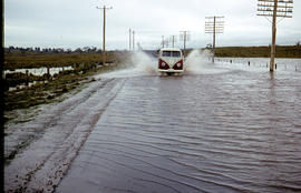
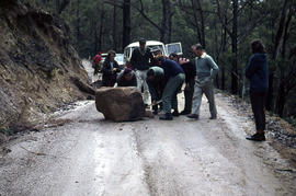
Flooded Midland Highway 1964
Add to clipboard
Colour photograph shows Volkswagen combi van being driven through floodwaters across Midland Highway 1964
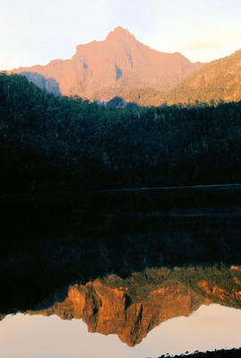
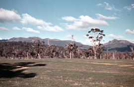
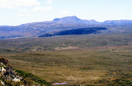
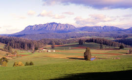
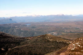
Farmland near Mount Roland
Add to clipboard
Colour photograph shows cloud above mountain ranges, looking west to Mount Heemskirk from Mount Murchison
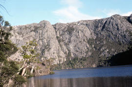
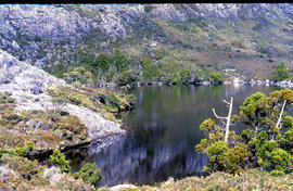
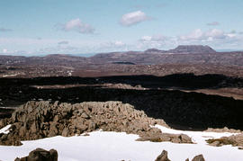
Crater Lake
Add to clipboard
Colour photograph shows Crater Lake
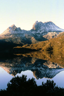
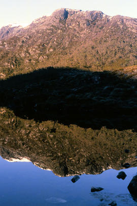
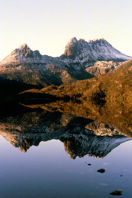
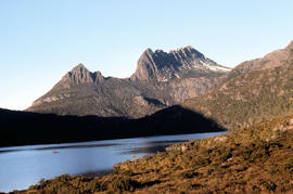
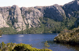
Cradle Mountain and Dove Lake
Add to clipboard
Colour photograph shows flecks of snow on upper ridges of Cradle Mountain and land around Dove Lake, some of it cloaked in deep shadow
Close up of Crater Lake
Add to clipboard
Colour photograph shows shoreline of Crater Lake with sunlit cliffs on opposite bank
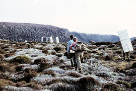
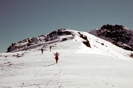
Climbing Naturalist Peak in snow
Add to clipboard
Colour photograph shows five figures in the snow, walking or skiing to the top of Naturalist Peak near Mount Field West, in Mount Field National Park. Some marks on original physical scanned image
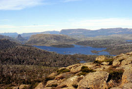
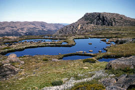
Chalice Lake and Mount Rogoona
Add to clipboard
Colour photograph of Chalice Lake and Mount Rogoona GIS: Latitude -4188 Longitude 14619 Gazetteer Record_ID TAS02032
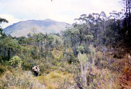
Bushwalking near Gordon River
Add to clipboard
Colour photograph shows bushwalker with backpack in heath and woodland walking towards the Gordon River
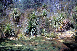
Bushwalker near Mount Lord
Add to clipboard
Colour photograph shows man in red and black check bush shirt standing in bush on Mount Lord, looking west. Man is standing amid tall specimens of Pandani, Richea pandanifolia
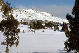
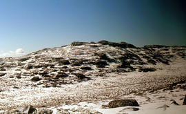
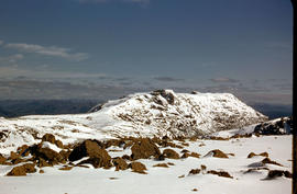
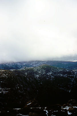
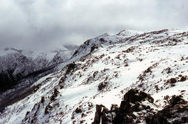
Ben Lomond plateau
Add to clipboard
Colour photograph shows Ben Lomond plateau with partial snow cover and blackened ground
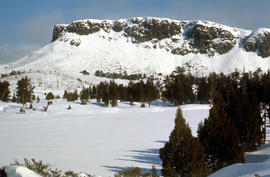
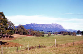
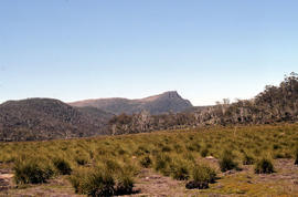
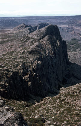
Bare Mountain
Add to clipboard
Colour photograph of Bare Mountain, with evidence of past bushfire damage to trees on lower slope GIS: Latitude -4149 Longitude 14590 Gazetteer Australia Record_ID TAS23466
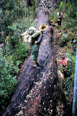
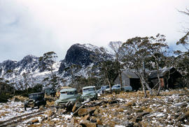
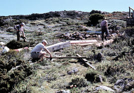
Assembling hut at K Col
Add to clipboard
Colour photograph shows people assembling the roof frame of a Hobart Walking Club hut at K Col, later named the FA. Peterson Memorial Hut and officially opened in 1960 by New Zealand adventurer Sir Edmund Hilary
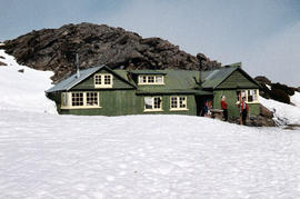
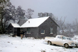
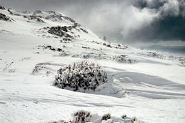
Alpine hut covered in snowdrift
Add to clipboard
Colour photograph shows footprints in snow leading to an alpine hut in a clearing, partially covered by snowdrift