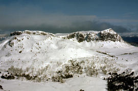
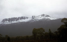
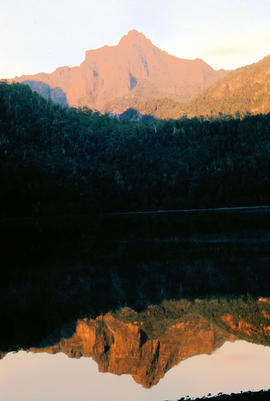
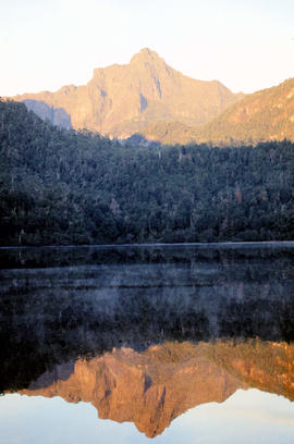
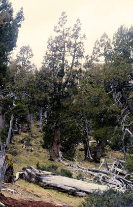
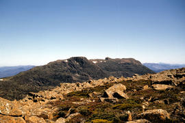
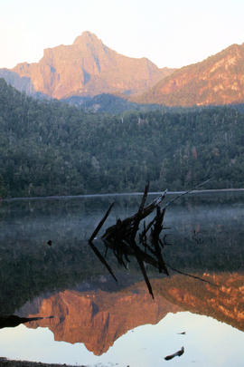
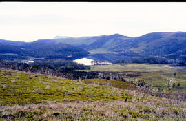
Snow cover on the Temple and West Wall at Mount Jerusalem
- AU TAS UTAS ITCCD 2017/2-367
- Item
- 1978
Part of Arthur Knight Slides
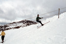
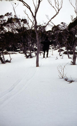
Colour photograph shows a snow vehicle taking a skier uphill at Ben Lomond 1960

288 results with digital objects Show results with digital objects
Snow cover on the Temple and West Wall at Mount Jerusalem
Part of Arthur Knight Slides
Colour photograph shows a snow vehicle taking a skier uphill at Ben Lomond 1960
Part of Arthur Knight Slides
Colour photograph shows snow covering Tarn Shelf in Mount Field National Park
Part of Arthur Knight Slides
Colour photograph of Strickland Valley near Ben Lomond, with partial snow cover, 1960
Part of Arthur Knight Slides
Colour photograph shows snow cover on Mount Ossa
Arthur Knight
Snow cover on Mount Olympus above Lake St Clair
Part of Arthur Knight Slides
Colour photograph shows snow above the treeline on Mount Olympus
Arthur Knight
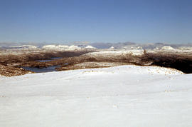
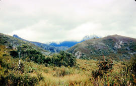
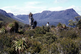
Snow cover at near Walls of Jerusalem looking to Mount Olympus and Mount Gould
Part of Arthur Knight Slides
Colour photograph shows snow skier standing on Mount Jerusalem
Part of Arthur Knight Slides
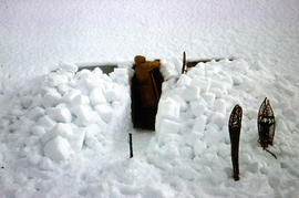
Colour photograph shows a snow cave excavation
Part of Arthur Knight Slides
Colour photograph shows snow at Jaffa Vale
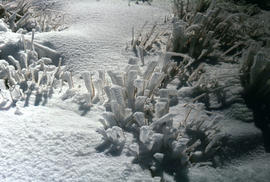
Snow and ice formations on tufts of grass
Part of Arthur Knight Slides
Colour photograph shows snow atop Mount Ophel

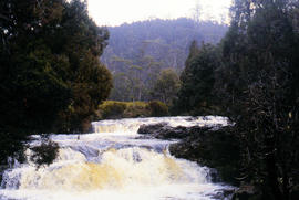
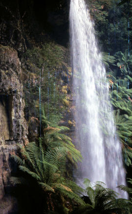
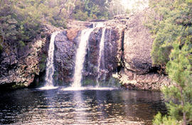
Small waterfall above Grail Falls
Part of Arthur Knight Slides
Colour photograph shows snow formation at Jaffa Gate
Part of Arthur Knight Slides
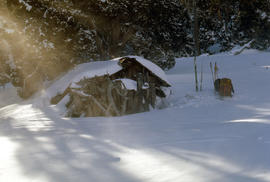
Colour photograph shows two sets of skis and backpacks outside an alpine hut, covered in a snowdrift
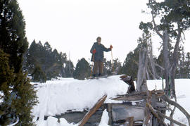
Skiing on the roof of Dixons Kingdom
Part of Arthur Knight Slides
Colour photograph shows buildings on Ben Lomond
Part of Arthur Knight Slides
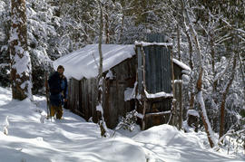
Colour photograph shows three snow skiers outside a trapper's hut in the snow
Part of Arthur Knight Slides
Colour photograph shows people ice skating on frozen surface of Lake Dobson
Part of Arthur Knight Slides
Colour photograph shows afternoon reflection of Mount Anne on the surface of water of Lake Timk
Signs at entrance to Mount Field National Park
Part of Arthur Knight Slides
Colour photograph shows signs posted at entrance of Mount Field National Park, with distances and estimated travel times to Lake Dobson (9 1/4 miles), Lake Fenton (7 1/4 miles), Lady Barron Falls (1 1/2 mile), Camping Ground (250 yds), Rangers Cottage (150 Yds), Russell Falls 1/2 MILE 10 MIN, Lady Barron Falls Round Trip 3 1/2 MILES 1H 45 MIN
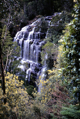
Side view of water flowing over Marriotts Falls
Part of Arthur Knight Slides
Colour portrait format photograph shows side view of the vertical drop of Marriotts Falls
Shrub frozen at Mount Field West
Part of Arthur Knight Slides
Colour photograph shows ice formation on branches of shrub at Mount Field West, 1968
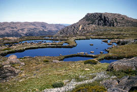
Shoreline of Lake Chalice 1979
Part of Arthur Knight Slides
Colour photograph shows the rocky shoreline of Chalice Lake GIS: Latitude -4188 Longitude 14615 Gazetteer Australia Record_ID TAS02044
Shoreline of Great Lake at Breona
Part of Arthur Knight Slides
Colour photograph depicts northern shoreline of Great Lake and settlement of Breona
Arthur Knight
Part of Arthur Knight Slides
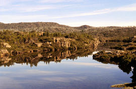
Colour photograph shows shoreline of Cloister Lagoon GIS: Latitude -4189 Longitude 14617 Gazetteer Australia Record_ID TAS02046
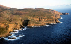
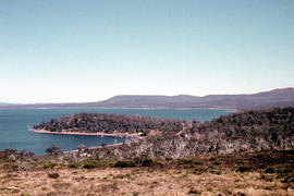
Setting sun shines on headland east of Cloudy Bay
Part of Arthur Knight Slides
Colour photograph of headland east of Cloudy Bay, illuminated by low setting sun.
Section of old bridge at Alonnah
Part of Arthur Knight Slides
Colour photograph of old Hobart Bridge section tethered offshore at Alonnah
Rusted locomotive in bush near Sharpes Siding
Part of Arthur Knight Slides
Colour photograph shows rusted locomotive with vertical boiler in bush near Sharpes Siding, a siding near Lake Tyenna Valley railway.
Part of Arthur Knight Slides
Colour photograph shows the arches of the sandstone bridge at Ross that leads across the Macquarie River
Arthur Knight
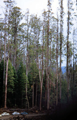
Rigger in the Florentine Valley
Part of Arthur Knight Slides
Colour photograph shows timber worker wearing hard hat, chaps and holding ropes and an axe, standing on fallen logs in the Florentine Valley
Part of Arthur Knight Slides
Colour photograph shows snow skiers on Mount Mawson, one using a tow rope to climb uphill
Ridgeline of Mount Mawson as viewed from Lake Dobson
Part of Arthur Knight Slides
Colour photograph shows snow on the ridgeline of Mount Mawson as viewed from Lake Dobson
Part of Arthur Knight Slides
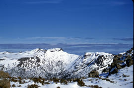
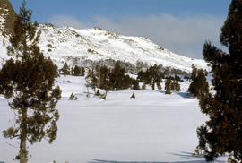
Colour photograph shows ridge line of Florentine Peak, with small patches of snow in foreground
Part of Arthur Knight Slides
Colour photograph shows three people resting at Newdegate Pass in Mount Field National Park
Reflections upon surface of Lake Chalice 1979
Part of Arthur Knight Slides
Colour photograph shows reflections of alpine vegetation in Chalice Lake 1979 GIS: Lake Latitude -4188 Longitude 14615 Gazetteer Australia Record_ID TAS02044
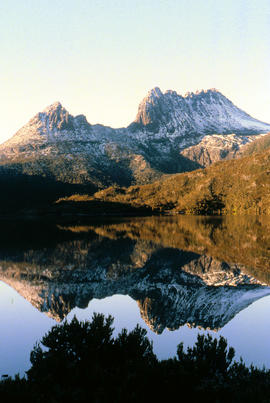
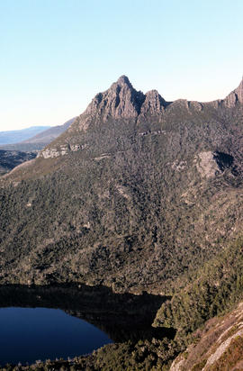
Reflection of mountain on surface of Dove Lake
Part of Arthur Knight Slides
Colour photograph shows light dusting of snow on Cradle Mountain, visible also from reflection in Dove Lake in foreground
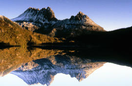
Reflection of mountain on still surface of Dove Lake
Part of Arthur Knight Slides
Colour photograph shows reflection of Cradle Mountain on surface of Dove Lake Image of mountain slightly out of focus
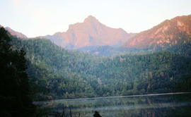
Reflection of Mount Anne on surface of Lake Timk
Part of Arthur Knight Slides
Colour portrait format photograph shows reflection of Mount Anne on the surface of Lake Timk
Part of Arthur Knight Slides
Colour photograph shows the Red Bridge, a convict built arch bridge across Elizabeth River at Campbell Town
Arthur Knight
Part of Arthur Knight Slides
Colour photograph shows rusted International Harvester locomotive on disused rails covered with bracken in a semi-cleared area of land
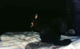
Part of Arthur Knight Slides
Colour photograph shows a possum eating something in the snow at Lake Dobson 1968
Portrait format view of reflection of Mount Anne on surface of Lake Timk
Part of Arthur Knight Slides
Colour photograph shows peaks in the Du Cane mountain range including Mount Geyron, as viewed from Cathedral Mountain
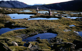
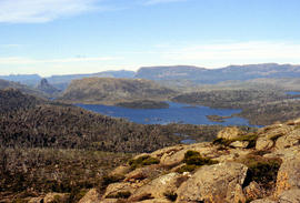
Pool of Siloam and the West Wall of Mount Jerusalem
Part of Arthur Knight Slides
Colour photograph shows dolerite peak of Ragged Jack, near Ben Lomond, viewed across from lightly timbered farmland
Pool of Siloam & The Temple 1978
Part of Arthur Knight Slides
Colour photograph shows snow covering Pool of Siloam near the West Wall of Mount Jerusalem
Part of Arthur Knight Slides
Colour photograph shows snow covering the Pool of Siloam near The Temple below Mount Jerusalem
Part of Arthur Knight Slides
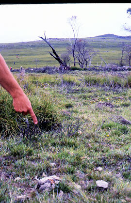
Colour photograph shows a person pointing at a dead bird on the ground near Bare Mountain, with new undergrowth shooting after a recent bushfire and several bushwalkers visible in the distance
Part of Arthur Knight Slides
Colour photograph shows creek running through snow and ice on plateau above Cradle Mountain
Picnic hut near National Park entrance
Part of Arthur Knight Slides
Colour photograph shows picnic hut near road entrance of Mount Field National Park
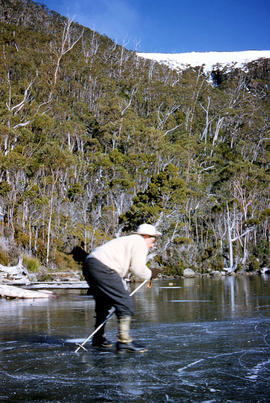
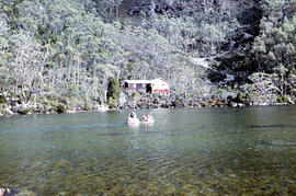
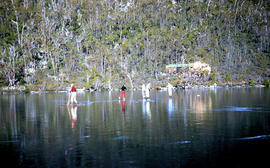
People skating on Lake Dobson 1954
Part of Arthur Knight Slides
Colour photograph shows people skating on frozen surface of Lake Dobson, 1954
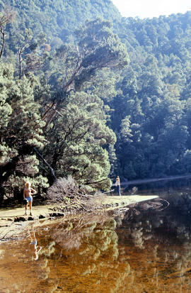
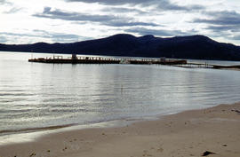
People on shore of Lake Timk 1974
Part of Arthur Knight Slides
Colour photograph shows people on western shore of Lake Timk 1974
People gather in timber work site
Part of Arthur Knight Slides
Colour photograph shows people in travelling clothes gathered at a timber work site clearing in the Florentine Valley
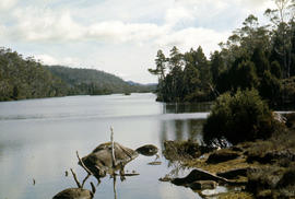
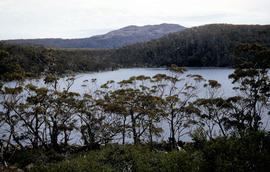
Pencil Pines on shore of Crater Lake
Part of Arthur Knight Slides
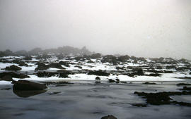
Colour photograph shows Crater Lake, with remnants of snow on rock ledge
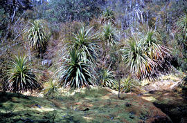
Pencil Pines near Dixons Kingdom
Part of Arthur Knight Slides
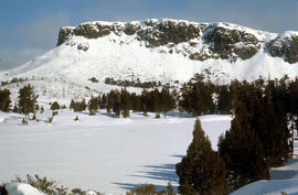
Colour photograph shows Piesse Vale at Ben Lomond plateau dusted with snow GIS Latitude -4154 Longitude 14763 Gazetteer Record_ID TAS13722
Part of Arthur Knight Slides
Colour photograph shows Pencil Pines growing in alpine forest near Dixons Kingdom hut
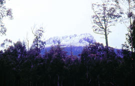
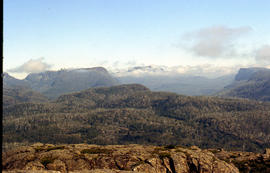
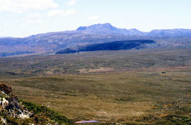
Panoramic view of Mount Rogoona
Part of Arthur Knight Slides
Colour photograph shows farmland in the Kentish area with Mount Roland in background
Part of Arthur Knight Slides
Colour photograph shows whitewater section of Pencil Pine Creek
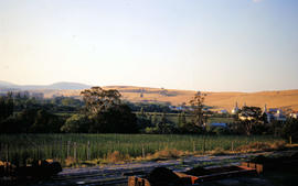
Paddocks on outskirts of Campbell Town
Part of Arthur Knight Slides
Colour photograph shows sheep in paddocks on outskirts of Campbell Town
Arthur Knight
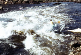
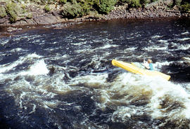
Part of Arthur Knight Slides
Colour photograph shows man paddling kayak on Derwent River near site of Repulse Dam
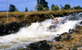
Paddler on whitewater course at Bradys Lake
Part of Arthur Knight Slides
Colour photograph shows paddler on whitewater course on Woodwards Canal, a man-made water course carved between Bradys Lake and Bronte Lagoon by the Hydro Electric Commission during construction of a hydro-electric power scheme
Paddler in the Cruncher at Bradys Lake
Part of Arthur Knight Slides
Colour photograph shows a paddler of a kayak in the Cruncher a segment of water on the Bradys Lake whitewater course
Part of Arthur Knight Slides
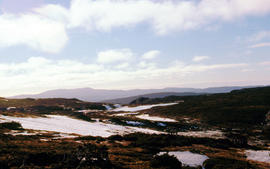
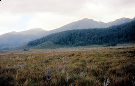
Colour photograph shows Lake Newdegate
Part of Arthur Knight Slides
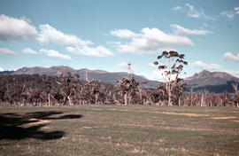
Colour photograph shows open paddock and mature eucalypt trees with Ben Lomond in the distance
Oast houses and hop fields at Macquarie Plains
Part of Arthur Knight Slides
Colour photograph shows hop fields and kilns, or oast houses, at Macquarie Plains, with rail wagons and railway line in foreground
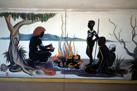
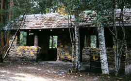
Mural in Hobart Walking Club hut
Part of Arthur Knight Slides
Colour photograph shows a mural in the Hobart Walking Club hut at Lake Dobson Source
Part of Arthur Knight Slides
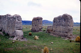
Colour photograph shows ruins of former probation station and convict labour accommodation at Jericho, built with rammed mud walls
Arthur Knight

Part of Arthur Knight Slides
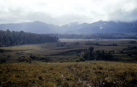
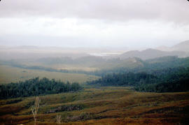
Colour photograph taken from elevated mountain ridge, shows valley floor looking west to Mount Solitary and original shoreline of Lake Pedder
Moving firewood at Lake Dobson
Part of Arthur Knight Slides
Colour photographs shows three people in a small boat laden with firewood being moved from one side of Lake Dobson to another. Hut visible on shore and cleared path of zig-zag track up hill visible in background
Part of Arthur Knight Slides
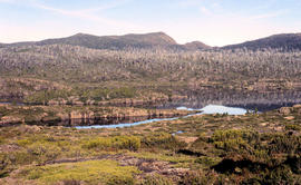
Colour photograph shows Mount Rogoona with Lake Myrtle obscured by light alpine forest vegetation on ridge
Mount Ossa and Cathedral Mountain
Part of Arthur Knight Slides
Colour photograph shows rocky peak of Mount Rogoona, with alpine plain in foreground
Mount Mueller from beyond Damper Inn hut
Part of Arthur Knight Slides
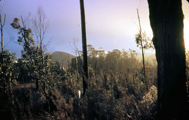
Colour photograph shows lightly timbered woodland near Mount Mueller
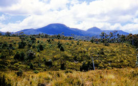
Mount Ida and Lake Payanna 1979
Part of Arthur Knight Slides
Colour photograph shows cloud encircling Mount Ossa and clear skies around nearby Cathedral Mountain
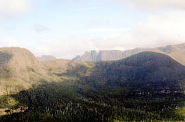
Mount Geyron from Cathedral Mountain
Part of Arthur Knight Slides
Colour photograph shows Lake Payanna and Mount Ida
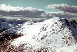
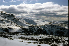
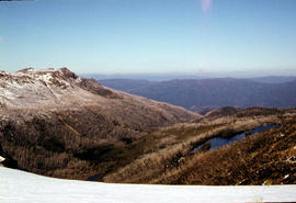
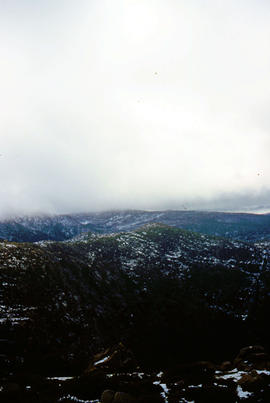
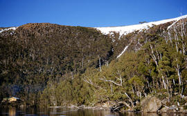
Mount Field West under snow as viewed from Rodway Range
Part of Arthur Knight Slides
Colour photograph from bank of River Derwent shows twisted railway track
Part of Arthur Knight Slides
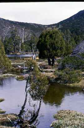
Colour photograph shows small tarns on alpine plateau at Mount Field West
Mount Field West from Rodway Range
Part of Arthur Knight Slides
Colour photograph shows Mount Field West from the Rodway Range
Mount Eliza covered in low cloud
Part of Arthur Knight Slides
Colour photograph shows lightly timbered heath and woodland and Mount Eliza in the background covered in low cloud
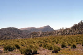
Mount Bowes from Sandfly Creek
Part of Arthur Knight Slides
Colour photograph shows Mount Bowes as viewed from Sandfly Creek
Part of Arthur Knight Slides
Colour photograph shows Mount Anne at sunrise as viewed from across Lake Timk
Part of Arthur Knight Slides
Colour photograph shows silhouette of Mount Anne, viewed at sunset
Part of Arthur Knight Slides
Colour photograph shows mossy ground surrounding a group of pandani plants
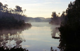
Misty morning at Cloister Lagoon
Part of Arthur Knight Slides
Colour photograph shows mist above the surface of Cloister Lagoon just before daybreak
Missing rail section across River Derwent at Macquarie Plains bridge
Part of Arthur Knight Slides
Colour photograph from bank of River Derwent shows twisted railway track
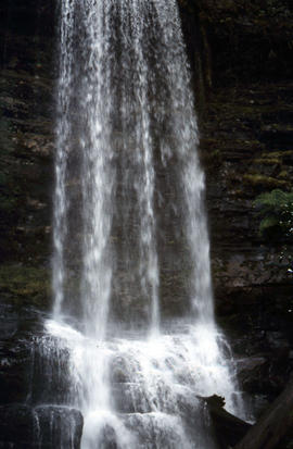
Part of Arthur Knight Slides
Colour portrait format photograph shows the vertical drop of Marriotts Falls
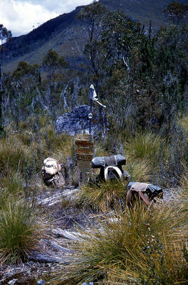
Marker on South Gordon walking track
Part of Arthur Knight Slides
Colour photograph shows unusual sign for South Gordon walking track turnoff, fashioned out of number plates, with three backpacks resting on ground nearby
Man skiing downhill on Mount Field West
Part of Arthur Knight Slides
Colour photograph shows man skiing downhill at Mount Field West, with two other figures behind him near the summit of mountain
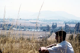
Man sitting in long grass at Plenty
Part of Arthur Knight Slides
Colour photograph shows many with dark hair and spectacles sitting on the edge of cleared farmland at Plenty beside river
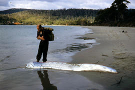
Man inspects ribbon fish on beach
Part of Arthur Knight Slides
Colour photograph of man looking at ribbonfish washed up on beach at Adventure Bay, Bruny Island
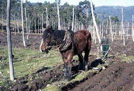
Man and horse ploughing at Westerway
Part of Arthur Knight Slides
Colour photograph shows a farmer ploughing a paddock at Westerway in a field strung with trellis frames for hop cultivation with a draught horse and plough
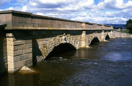
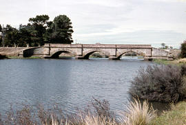
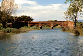
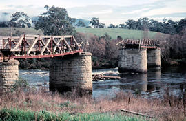
Macquarie River at Ross Bridge
Part of Arthur Knight Slides
Colour photograph shows Ross Bridge across Macquarie River
Arthur Knight
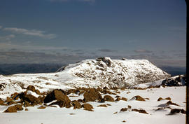
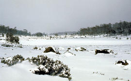
Low visibility on Mount Mawson plateau
Part of Arthur Knight Slides
Colour photograph shows ice and snow amid rocky outcrops on Mount Mawson plateau
Part of Arthur Knight Slides
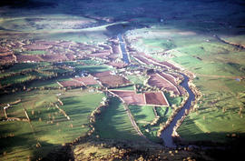
An aerial colour photograph shows distinctive shelter belts around cultivated hop fields alongside River Derwent at Bushy Park, Glenora and Macquarie Plains. Long shadows being cast from the low sun to the west
Part of Arthur Knight Slides
Colour portrait format photograph shows low cloud over Mount Bridges, with patches of snow on the ground
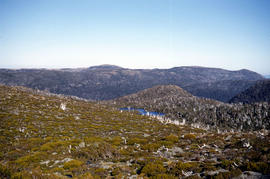
Looking south to Cradle Mountain
Part of Arthur Knight Slides
Colour photograph shows the heathland on the Central Plateau, south of Cradle Mountain, with the mountain peaks visible in the distance

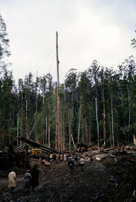
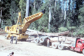
Logs from the Florentine Valley
Part of Arthur Knight Slides
Colour photograph shows a crane being used to load logs on a semi-trailer in the Florentine Valley. Inscription on driver's door reads L.J. Reynolds, HAULAGE CONTRACTOR, Maydena, Phone 217. Visible at lower left of image are people in street or travelling clothes on an outing to view timber workers in the bush
Loading firewood at Lake Dobson
Part of Arthur Knight Slides
Colour photograph shows six people loading sawn timber offcuts into a small dinghy on the edge of Lake Dobson
Loading a semi-trailer with logs in Florentine Valley
Part of Arthur Knight Slides
Colour photograph shows a crane being used to load up a semi-trailer to carry logs from the Florentine Valley. inscription on driver's door reads, L.J. Reynolds, HAULAGE CONTRACTOR, Maydena, Phone 217
Part of Arthur Knight Slides
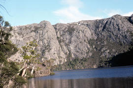
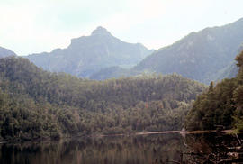
Colour portrait format photograph shows Lake Wilks and Little Horn near Cradle Mountain
Part of Arthur Knight Slides
Colour photograph shows Lake Timk and Mount Anne in distance GIS: Latitude -4293 Longitude 14646 Gazetteer Australia Record_ID TAS16882
Lake Loane under snow cover 1978
Part of Arthur Knight Slides
Colour photograph shows Lake Loane beneath blanket of snow, from near the Horse Track 1978
Lake Lea from Prospect Mountain
Part of Arthur Knight Slides
Colour photograph shows Lake Lea from Prospect Mountain near Vale of Belvoir
Part of Arthur Knight Slides
Colour photograph shows Lake Fenton
Part of Arthur Knight Slides
Colour photograph shows low cloud obscuring the forest and ridgelines where Lake Edgar is visible in the distance
Part of Arthur Knight Slides
Colour photograph of limited water flow across Knyvet Falls 1984 GIS: Latitude -4159 Longitude 14593 Gazetteer Australia Record_ID TAS06008
Kayaking in rapids of Derwent River
Part of Arthur Knight Slides
Colour photograph shows a lone kayaker navigating whitewater on the Derwent River below the Repulse Dam site